
"Cycleship Shimanami"
main route

Popular trip to Omishima, Ikuchijima and Innoshima
This special cycling course, which covers three particularly popular islands, is made possible by using the Shimanami Cycle Ship. You can cycle freely between Miyanoura Port and Shigei Nishi Port within the allotted time. You can also enjoy sightseeing at Oyamazumi Shrine and the Setoda area in one day
For individual travel
Shimanami Kaido


Route map
Cycling information
| Distance | Approximately 30km (travel time approximately 3-4 hours) |
|---|---|
| Difficulty | Beginners are OK too |
| Things to note | There is one mountain pass between Miyaura and Kamiura on Omishima Island. You can reach Tatara Bridge and Ikuchi Bridge via the approach road. |

A magnificent bridge that connects them with the islands scattered across the beautiful sea.
The beauty of the Shimanami Kaido is a blend of rich nature and people's lives, giving us time to relax.
We read the scenery of the Shimanami Kaido as "Shimanami Scenes."

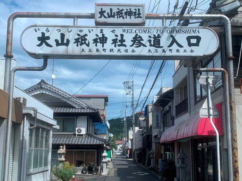
Omishima
Approach Shopping Street (Miyaura)
Monzen-dori has slowly been remodeled with the times. The same streets where locals once hopped around on their "mamachari" (mamachari) bicycles, now cyclists come and go, are lined with general stores, dry cleaners, clothing stores, and more. The island's Legal Affairs Bureau has been renovated into the "Omishima Minna no Ie" (Home for Everyone), and the long-established "Oshima Manju" store has continued to look after worshippers. The shopping street along the approach to the temple, which still retains the original scenery of the temple town, is perfect for a leisurely ride
Ikuchi Island
Takane Bridge (Takane Island)
This farm road bridge, painted orange-yellow, straddles the Setoda Channel. Along with the view of the mandarin orange orchards that "cultivate and reach the sky" from the foot of the mountain at an altitude of 322m, it is a symbol of the mandarin orange island of Takanejima. The story goes that the reason this bridge was built was to transport mandarins from Takanejima to Ikuchijima, which gives us an idea of the prosperity of mandarin orange farming at the time. It's no wonder that it's painted orange-yellow
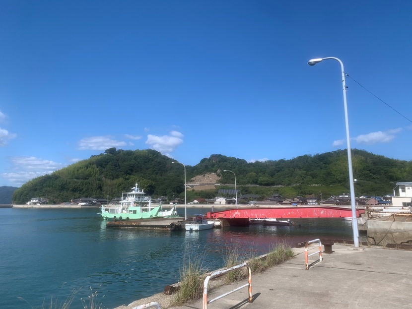
Innoshima
Shigei West Port (Shigei)
Innoshima stretches approximately 10km north to south and 5km east to west, stretching somewhat narrowly. Driving along the coast, you'll notice the continuous sequence of opposite shores, including Ikuchijima and Sakijima, and the narrowness of the island's characteristic flatlands. This is no surprise, as most of the island's flat land is reclaimed land, with peaks over 200m high rising straight up into the sky from the Seto Inland Sea. Place names such as "XX Shinkai," which refer to reclaimed land, have been passed down on the island, and remnants of this name can be seen in Shigei, the northern center of Innoshima. On a boat trip from Shigei Nishi Port, where high-speed boats to Mihara Port and remote island ferries to Hososhima depart and arrive, you can gaze up at the twin peaks of Mount Ryuo (243m) and Mount Shirataki (226m), and be captivated by the beauty of the islands as described by poet Isamu Yoshii