
Recommended boat and bicycle

Landing on Osakikamijima by sea from the Geiyo Nada Islands
The bridge connects the historic and romantic townscapes of Mitarai and Kinoe with seven atmospheric islands. The route crosses the main road, the Shimanami Kaido, to the Akinada Tobishima Kaido, also known as the back of Shimanami. Cycle Ship Shimanami makes this a route that repeat visitors long for
For group travel
Tobishima Sea Road


Route map
Cycling information
| Distance | Approximately 42km (travel time approximately 5-6 hours) |
|---|---|
| Difficulty | For beginners to intermediate |
| Things to note | To reach Tatara Bridge, you will need to climb the approach road. Apart from the bridge, the route is flat and easy to follow. |

A magnificent bridge that connects them with the islands scattered across the beautiful sea.
The beauty of the Shimanami Kaido is a blend of rich nature and people's lives, giving us time to relax.
We read the scenery of the Shimanami Kaido as "Shimanami Scenes."

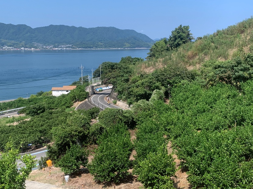
Ikuchi Island
Lemon Valley
Ikuchijima is said to be the birthplace of domestic lemons, and since reaching the top of Japan in production volume in 1963 (Showa 38), it has not relinquished its throne for nearly 60 years. This lemon island has earned the name "Lemon Valley" for the view of lemon fields that "cultivate to the heavens"! Climb the road that leads straight up from the outer coastal road to the heavens, and you will be greeted by a stylish terrace. Be awed by the Tatara Bridge stretching out to Omishima at eye level, and relax in the deep green of the lemon fields below. Feel the sun and wind all over your body and you'll feel like a lemon!
Osaki Shimojima
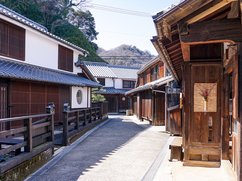
Mitarai Townscape
Mitarai was designated an Important Preservation District for Groups of Traditional Buildings in 1994 (Heisei 6). Along with Tomo (Fukuyama City), its port townscape is preserved and utilized. The driving force behind Mitarai's birth and development as a port town was the Kitamae-bune ships. The Nishimawari sea route was developed in 1672 (Kanbun 12) to transport rice from Sakata (Shonai) to Edo (present-day Tokyo) along the Mogami River. The Kitamae-bune ships used this route to promote trade. Mitarai was established in 1666 (Kanbun 2) when the Hiroshima Domain laid out the town, and it prospered as a port of call for the Kitamae-bune ships, which were also known as "mobile general trading companies." The narrow streets leading to the port are lined with town houses, merchant houses, boathouses, temples and shrines, evoking the bustling scenery of bygone days
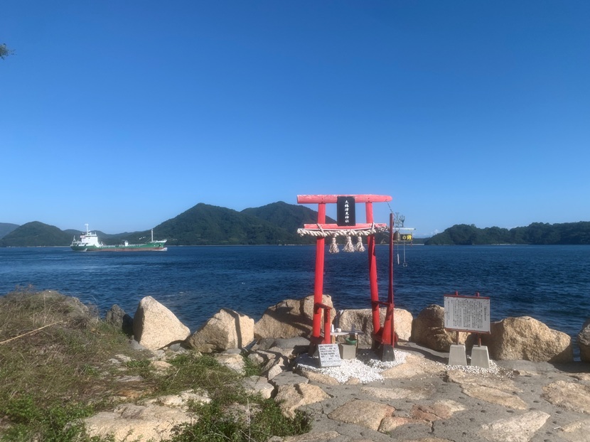
Osakikamijima
Torii gate of Owatatsumi Shrine
As you walk along the quiet sandy beach of Noga towards the tip of Nakanohana, you will see a red torii gate. Owatatsumi Shrine's stone monument, erected in 1937, eventually disappeared beneath the waves. In 2021 (Reiwa 3), it was discovered among the rocks on the shore, restored by volunteers, and a new red torii gate was erected. Kinoe once flourished as a port where people waited for favorable winds and tides. The more dazzling the light, the darker the shadows... its origins are inscribed with the sea at its back. Beyond the red torii gate stretches the blue of the sea and sky! Against this contrasting backdrop, ships leisurely cross the river... a space for prayer that reveals the soul